Kendua
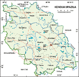
Kendua is an Upazila of Netrokona District in the Division of Dhaka, Bangladesh. Kendua is located at 24°39′00″N 90°50′30″E / 24.6500°N 90.8417°E / 24.6500; 90.8417.
It has 51,221 units of house hold and total area 303.6 km².
As of the 1991 Bangladesh census, Kendua has a population of 265,628. Males constitute are 50.58% of the population, and females 49.42%. Kendua has an average literacy rate of 37.1% (7+ years), and the national average of 51.00% literate.
Kendua has 13 Unions/Wards, 227 Mauzas/Mahallas, and 311 villages.
Madan
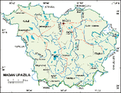
Madan is an Upazila of Netrokona District in the Division of Dhaka, Bangladesh. Madan is located at 24°43′00″N 90°58′00″E / 24.7167°N 90.9667°E / 24.7167; 90.9667 . It has 21,808 units of house hold and total area 225.85 km².
As of the 1991 Bangladesh census, Madan has a population of 117,613. Males constitute are 50.99% of the population, and females 49.01%. Madan has an average literacy rate of 18.7% (7+ years), and the national average of 32.4% literate.
Madan has 8 Unions/Wards, 95 Mauzas/Mahallas, and 120 villages.
As of the 1991 Bangladesh census, Madan has a population of 117,613. Males constitute are 50.99% of the population, and females 49.01%. Madan has an average literacy rate of 18.7% (7+ years), and the national average of 32.4% literate.
Madan has 8 Unions/Wards, 95 Mauzas/Mahallas, and 120 villages.
Atpara
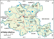
Atpara is an Upazila of Netrokona District in the Division of Dhaka, Bangladesh. Atpara is located at 24°48′30″N 90°52′00″E / 24.8083°N 90.8667°E / 24.8083; 90.8667 . It has 23,395 units of house hold and total area 195.13 km².
As of the 1991 Bangladesh census, Atpara has a population of 120,491. Males constitute are 51.15% of the population, and females 48.85%. Atpara has an average literacy rate of 24% (7+ years), and the national average of 32.4% literate.
Atpara has 7 Unions/Wards, 142 Mauzas/Mahallas, and 175 villages.
Barhatta
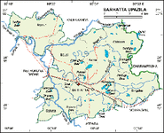
Barhatta is an Upazila of Netrokona District in the Division of Dhaka, Bangladesh. Barhatta is located at 24°54′00″N 90°52′30″E / 24.9000°N 90.8750°E / 24.9000; 90.8750 . It has 26,683 units of house hold . It is located on the banks of the Kangsha River close to the haor areas.
Barhatta Upazila with an area of 221.50 sq km is bounded by Kalmakanda and Dharmapasha upazilas on the north, Atpara and Mohanganj upazilas on the south, Mohanganj and Dharmapasha upazilas on the east and Netrokona sadar upazila on the west. Main rivers are Dhalai and Kangsha; noted canals are Nalhati and Aothitpur; noted depressions Kalahogla Beel, Magura Beel, Lungi Beel, Urha Beel, Makra Beel and Naldugi Beel.
As of the 1991 Bangladesh census, Barhatta has a population of 142,174. Males constitute are 51.42% of the population, and females 48.58%. This Upazila's eighteen up population is 71,214. Barhatta has an average literacy rate of 23.8% (7+ years), and the national average of 32.4% literate.
Barhatta has 7 Unions/Wards, 148 Mauzas/Mahallas, and 228 villages.
Mohanganj
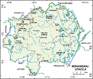
Mohanganj is located at [show location on an interactive map] 24°52′00″N 90°58′00″E / 24.8667°N 90.9667°E / 24.8667; 90.9667. It has 24011 units of house hold and total area 243.2 km².
As of the 1991 Bangladesh census, Mohanganj has a population of 129,415. Males constitute are 51.4% of the population, and females 48.6%. Mohanganj has an average literacy rate of 27.8% (7+ years), and the national average of 32.4% literate. Mohanganj thana was turned into an upazila in 1982. Mohanganj has 07 Unions & 01 pouroshobha. Telephone Dialing Format: International - 880 (09524), National - 0 (9524).
Mohanganj Pilot Govt. High School (1931), Mohongonj Pilot Girls high school(1952), Mohanganj Public High School(1981), Mohongonj Adorsho High School(1989), Khan Bahadur Kabir Uddin Khan High School, Shampur Union High School(1969), Khurshimul high school(1965), Magan high school(1971), Sesrakali shahid smrety high school(1966), Borantor Adorsho high school(1987), Joinpur high school, Paikura Junior high school(1969), Birampur high school(1994), Somaj high school(1964), Naraish Junior high school, Palgoan high school,Hashla high school, MuktiZudda Smrety Junior high school, Mohanganj Degree College, Mohanganj Girls’ College.
Kalmakanda
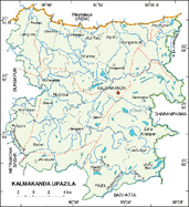
Kalmakanda is an Upazila of Netrokona District in the Division of Dhaka, Bangladesh. Kalmakanda is located at [show location on an interactive map] 25°05′00″N 90°53′30″E / 25.0833°N 90.8917°E / 25.0833; 90.8917 . It has 39275 units of house hold and total area 377.41 km².
As of the 1991 Bangladesh census, Kalmakanda has a population of 209,360. Males constitute are 50.99% of the population, and females 49.01%. Kalmakanda has an average literacy rate of 21.4% (7+ years), and the national average of 32.4% literate.
Kalmakanda has 8 Unions/Wards, 179 Mauzas/Mahallas, and 343 villages.
Purbadhala
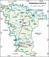
Purbadhala is an Upazila of Netrokona District in the Division of Dhaka, Bangladesh. Purbadhala is located at [show location on an interactive map] 24°56′00″N 90°36′10″E / 24.9333°N 90.6028°E / 24.9333; 90.6028 . It has 44799 units of house hold and total area 312.3 km².
As of the 1991 Bangladesh census, Purbadhala has a population of 235675. Males constitute are 50.79% of the population, and females 49.21%. This Upazila's eighteen up population is 114878. Purbadhala has an average literacy rate of 23% (7+ years), and the national average of 32.4% literate.
Purbadhala has 12 Unions/Wards, 229 Mauzas/Mahallas, and 334 villages.
Durgapur
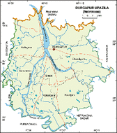
Durgapur is an Upazila of Netrokona District in the Division of Dhaka, Bangladesh. Durgapur is located at 25°07′30″N 90°41′15″E / 25.1250°N 90.6875°E / 25.1250; 90.6875 . It has 32,245 units of house hold and total area 293.42 km². Durgapur Upazila is such a unique place where river of clean water, hills, sands make a heavenly natural environment.
As of 1991 Bangladesh census, Durgapur has a population of 169,135. Males constitute are 50.49% of the population, and females 49.51%. This Upazila's eighteen up population is 83795. Durgapur has an average literacy rate of 23% (7+ years), and the national average of 32.4% literate.
Durgapur has 7 Unions/Wards, 134 Mauzas/Mahallas, and 215 villages.
Khaliajuri
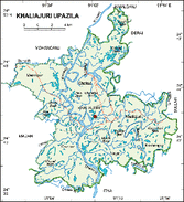
Khaliajuri is an Upazila of Netrokona District in the Division of Dhaka, Bangladesh. Khaliajuri is located at [show location on an interactive map] 24°42′00″N 91°07′30″E / 24.7000°N 91.1250°E / 24.7000; 91.1250 . It has 12,903 units of house hold and total area 297.64 km².
As of the 1991 Bangladesh census, Khaliajuri has a population of 75,801. Males constitute are 52.31% of the population, and females 47.69%. This Upazila's eighteen up population is 39052. Khaliajuri has an average literacy rate of 21.5% (7+ years), and the national average of 32.4% literate.
Khaliajuri has 6 Unions/Wards, 68 Mauzas/Mahallas, and 66 villages.
Netrokona Sadar
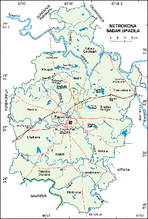
Netrokona Sadar is an Upazila of Netrokona District in the Division of Dhaka, Bangladesh. Netrokona Sadar is located at [show location on an interactive map] 24°52′30″N 90°44′00″E / 24.8750°N 90.7333°E / 24.8750; 90.7333 . It has 51039 units of house hold and total area 340.35 km².
As of the 1991 Bangladesh census, Netrokona Sadar has a population of 265,643. Males constitute are 51.36% of the population, and females 48.64%. This Upazila's eighteen up population is 134197. Netrokona Sadar has an average literacy rate of 28.4% (7+ years), and the national average of 32.4% literate.
Netrokona Sadar has 15 Unions/Wards, 317 Mauzas/Mahallas, and 344 villages.
